An increasing number of residents of large cities are beginning to give preference to rest in the wild, trying to get away from the very fast rhythm of life around them. Traveling by car or off-road transport is gaining popularity. The main thing during such trips is not to get lost and find the way back. Unfortunately, far from always in the wilderness there is not only access to the Internet, but even to ordinary mobile communications. To properly navigate the terrain, there are special programs for installation on a smartphone or tablet - navigators that work without connecting to a network.
In general, there are a lot of applications of this kind, but choosing the most suitable one is not so easy, so we decided to write our today's rating of the best navigators for the Android platform of 2019, working without the Internet. Before analyzing the specific capabilities of each program, let’s figure out what they work on and what to look for when choosing and installing.
Summary of the rating:
Absolutely all modern devices running on the Android platform are equipped with a GPS module, which provides for constant communication with the satellite. This contact allows you to determine the location on the ground at any convenient time, regardless of whether there is a cellular signal or not. Approximately the same principle works and the navigator for the vehicle. All cards will be stored in the gadget's memory, so you won’t have to connect to the Internet each time to download them.
Developers are constantly improving their software. For example, if just a couple of years with the help of mobile navigators it was only possible to pave the way from one point to another, today you can find out all the necessary information about traffic jams caused by traffic accidents, traffic jams, where sights are located and so on. Another important function is the ability to obtain data on the presence on the route of posts of the road patrol service and cameras.
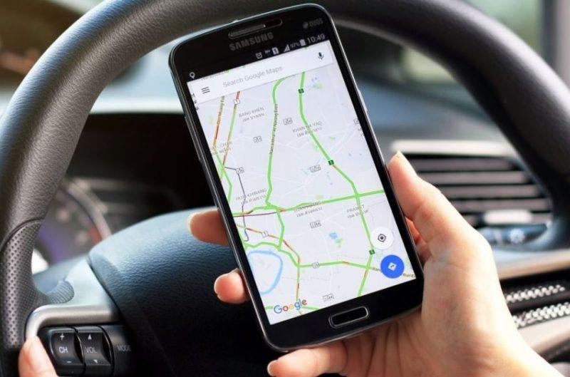
Before installing such an application, you should decide for what purpose it will be used. If you are going to travel exclusively around the country, then you can download an adapted program with detailed maps of the regions that you intend to visit. Utilities containing maps of many European and Asian countries are provided for traveling abroad.
Choosing applications for inclusion in our rating of the best navigators for Android, we, first of all, were guided by the fact that the program was absolutely free for users. In addition, we relied on all the above points and reviews of people who regularly use it on trips. We hope that you can choose for yourself the most optimal application that will allow you to comfortably go all the way. Now let's get down to analyzing the programs themselves.

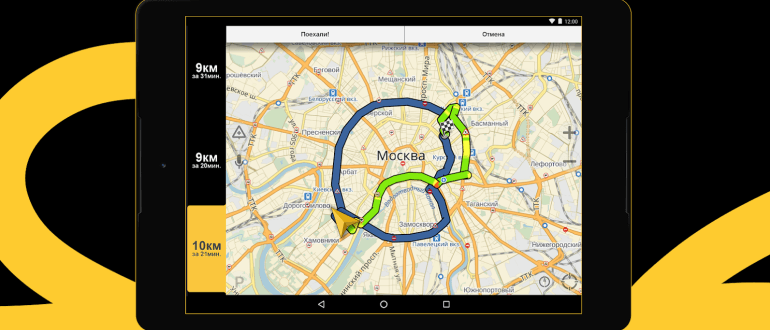
This program has become a real breakthrough in the field of applications designed for navigation. It will independently lay a route to a given point, taking into account the traffic situation - it will allow to bypass traffic jams, accidents and repair sites along the way. In this case, several driving options are compiled, of which the driver can choose the most suitable for him. If the road runs along a toll road, the user will be informed about this. When on the road, the remainder of the path is displayed on the screen, and this will be shown not only in kilometers, but also in minutes. Voice guidance is provided so that the person driving is once again not distracted by the gadget screen. The user interface is ergonomic and very user friendly. There are three main tabs on the main screen - favorites, map and search. If you wish, you can change the scale, return to the starting point, a compass is provided, an indicator showing how heavily loaded the roads are.
A very interesting and thoughtful solution is to paint the line of the path, depending on how much the road is loaded with cars in a certain section. It is worth noting that the application has not only voice guidance, but also voice commands - the user can get directions without even touching the device. The application operates not only on the android platform, but also on iOS. You don’t have to download maps separately, as they will be stored in the cache memory of this program. Using the utility is simple - it does not need any special settings.
Benefits:
- Low system requirements
- Quickly responds to any inquiries;
- Easy to use, no special configuration required;
- There is a voice assistant;
- Ergonomic interface.
Disadvantages:
- Without an Internet connection, it works a little.

It has a pretty nice and very clear interface, all cards are accurate and current. The program itself is absolutely free. There is everything necessary for comfortable use - the search is performed by the name of the city, street, and so on. The application does not weigh very much in the basic version, does not require high requirements, all maps are drawn smoothly. You can search directly for given objects, for example, catering establishments, gas stations and so on, and this applies not only to large or small cities, but also to highways. A standard set of cards is supplied as standard - it is not too large, so if necessary, you will have to download additional packages via the Internet, which is not always convenient and possible.
The program is multilingual, all touch keys are large, so clicking on them is very convenient even if the diagonal of the gadget is small. There is support for voice commands and voice of the route - several languages are also provided. The search is fast enough, the route is laid out in a few seconds, and the traffic situation is taken into account, which is tracked in real time via satellite. If necessary, the route that the user has traveled can be saved in order to use it again in the future.
Benefits:
- Completely free application, including downloadable map packages;
- All maps are regularly updated;
- Expanded base of road cameras;
- All cards have excellent detail.
Disadvantages:
- Card packages need a decent amount of free space that eats up the physical memory of the gadget;
- There is no function to build alternative routes.

It has very wide capabilities, most users claim that the application is very effective both in urban conditions and in rural areas. In general, this program is unique in many respects.In particular, the vehicle’s overall dimensions and some other parameters can be driven into it, in particular, axle load, maximum speed and so on. This allows the utility to select the optimal route that is able to take into account all the features of the machine. There is a very convenient and functional voice accompaniment, which voices all the maneuvers required from the driver in many languages, including Russian. If necessary, you can get a door-to-door route. Navigation is very convenient - it supports 2D and 3D formats, there are also several color schemes for design, which allows you to comfortably navigate the map depending on the time of day.
When moving, for example, when performing a turn or a turn, the card also turns, this is done completely automatically. In addition, the application allows the user to navigate around the world. The program will warn the user about the presence of cameras for fixing violations using a special sound signal. There are several operating modes - truck, passenger car or pedestrian. Accordingly, even a person looking for an object without a car will be able to use such a program. The developers provided for the preservation of the route, places of stay, the search on them is very convenient.
Benefits:
- Supports all known card formats, regardless of the development company;
- High level of performance;
- Completely free;
- Cards can be saved both in the memory of a mobile device and on a memory card;
- You can search for sights;
- Day and night modes;
- Stable offline work.
Disadvantages:
- On the maps of the countryside, the detail periodically lame;
- It does not always work stably;
- Traffic jams are delayed.
This software is installed in the personal computer of most domestic cars; not so long ago, developers decided to release an analogue for installation in any mobile device running on the Android platform. It is worth noting that in smartphones of some brands this utility comes as a pre-installed one. Unfortunately, for downloading additional cards you will have to pay extra money, and the package will be designed exclusively for one device. The map can be displayed either in standard or in panoramic mode, the latter format can be used only in conditions of scale less than 300 meters. As the scale is enlarged, the slope will increase. All buildings on the map are given without taking into account the number of floors.
Road junctions and tunnels are clearly indicated, especially if you use the panoramic mode. Passages through the yards are clearly visible on the maps of large cities. It is possible to display three-dimensional models of buildings, but there are not too many of them - only 9 for the capital and 4 for Yekaterinburg, in order to access them, you will have to download an additional extension and install it manually. The program does not need a large amount of system resources when working. The route can be selected using a number of possibilities, and in this case, you can specify the type of transport - on foot, by bicycle, by public transport, by taxi or private car or by truck. In any case, the path will be laid optimally, taking into account the traffic situation, weather conditions, road accidents and so on.
Benefits:
- It holds the route very precisely, rebuilding it if necessary;
- Friendly and intuitive interface;
- Extended program functionality;
- All maps are as accurate as possible;
- There are a large number of different settings.
Disadvantages:
- Updates do not come out as often as we would like.

This software for mobile devices first appeared on the market about 10 years ago.Users immediately appreciated the capabilities of this application. Despite the fact that the utility is formally free, it has a trial period, the duration of which is only seven days, after which the user will have to pay a certain amount, the size of which will directly depend on the number of cards purchased. At the same time, the owner of the gadget pays only once, there is no paid subscription here. He is given unlimited access to purchased cards, which will be updated free of charge online. The program is not too demanding on the system requirements of the device - it needs only a processor with a clock frequency of 600 MHz and 384 MB of RAM, the amount of free space on physical media is 150 MB. The interface is very convenient, provided for vertical and horizontal orientation. The dashboard can be adjusted to your preference.
All maps of this navigator have a three-dimensional route display mode. In general, the interface has practicality and ease of use. House numbers are shown straight along the way. The scale can be increased or decreased, and in the latter case, it will decrease until the entire planet is displayed on the screen. It’s comfortable to work with the map - there is an automatic filling of the search bar, queries to the database are made several times per second, so finding the right point on the map will not be too difficult.
Benefits:
- Perfect for both the driver and the hobbyist;
- Offline maps work very reliably and stably; they are updated if necessary;
- It searches for satellites online quickly, establishes a stable connection with them.
Disadvantages:
- You will have to pay for downloading maps.

Despite the fact that this program has existed for a long time, it is still very popular among users. First of all, the application is characterized by a rather simple interface that helps the user quickly determine what exactly is required of the utility at the moment. The working window is simple - there are no piling up of labels and icons, all elements are neatly and concisely. If necessary, the detail of the map can be increased by simple movements of two fingers. The application menu is located at the bottom of the screen, it also allows you to build an alternative route, especially if there is an accident or congestion on the way. Maps are not drawn very well, but their clarity is enough to understand where to go.
Voice search is weak, so you must enter the destination manually. It works stably in offline mode, but this application will not warn about the presence of cameras. The detail of roads directly depends on how large a settlement is, although even in small villages it will not be possible to go astray. If you purchase a premium version, then the functionality will be much wider.
Benefits:
- A fairly rich set of features, even in the free version;
- Paves the most optimal route;
- Additional cards are downloaded absolutely free;
- Able to work on absolutely any platform.
Disadvantages:
- Still, for direct use, it is desirable to have an Internet connection.

The creators of this utility focused primarily on the high quality of maps to the detriment of navigation, which performs extremely simple functions here. The program is available in two versions - paid and free. The latest version is limited to ten map downloads. If you do not travel too much or travel along approximately the same routes, then such an amount will be more than enough for you. For the right to use the paid version of the application, you will have to pay 200 rubles once.However, after this, a person is given the opportunity to download an unlimited number of maps of both our country and any other. Maps are made as detailed as possible, although not provided for in 3D mode. You can view downloaded maps and track them online. This is very convenient, and if necessary, they are laid one on top of the other.
All of them have separate colors, there are also day and night modes of use. There are no themes, there are no separation between summer and winter modes - this was done so that the application would weigh as little as possible. The road to the given point is paved quite quickly, no delays were noted in this regard. Downloaded maps are updated regularly - about a couple of times a month. In general, navigation is quite primitive, but there are all the main functions. The program can lay the optimal or fast route, but the state of the traffic situation is not taken into account.
Benefits:
- Available in free and paid mode, and the paid version is quite cheap;
- Clear study of all the cards;
- You can use it both with an Internet connection and offline.
Disadvantages:
- Weak navigation;
- There is no way to view the terrain in 3D.

In third place in our review of the best navigators for the Android platform without connecting to the Internet was an application created by programmers at Mail.ru. It can be used not only by drivers, but also by pedestrians or cyclists. Literally all routes are loaded into the utility’s memory, regardless of the way of movement. It works stably in offline mode, which saves not only Internet traffic, but also battery power. This is quite convenient for people traveling in areas where there is no mobile connection. The application and maps are updated regularly, so the routes are detailed and relevant. In these maps you can find objects that are not in other programs. When using the application by pedestrians, it will indicate the angle of incline when moving uphill or downhill. In the process of compiling the cards themselves, the users themselves take an active part.
Through this program, you can find various objects - hotels, ATMs, attractions. In order to use this feature, an Internet connection is also not required. However, in order to book a room in a hotel you like, you still have to go online. Through this application, you can send messages to other users indicating their own location. The cards are perfectly optimized for mobile gadgets, they do not weigh too much, and the system requirements are minimal.
Benefits:
- You can leave all kinds of labels;
- All maps are available for download absolutely free;
- Several options for creating routes;
- Convenient work offline.
Disadvantages:
- The interface is original, so you have to adapt to it.
2.2 GIS

Not just a navigator in the traditional concept of the word, but an online help desk that allows you to instantly find the organization you need and get the best route to your office. The application was developed by domestic programmers, so it has carefully drawn maps of only Russia and Ukraine. In the database you can find all the major federal highways, almost all cities of the country, and the maps are presented in both the traditional format and in the form of 3D images. This allows you to instantly navigate the terrain and immediately find the necessary house or office. The application does not weigh too much - only 15 MB, which against the background of other programs seems generally insignificant. The online version is in no way inferior to offline. Databases load quickly enough, and here you can even view panoramic pictures or go on a virtual tour of the village.
There is a clear differentiation of the organizations available in this application. The user can instantly find all the necessary companies located in the immediate vicinity of his location. There is a filter system that helps to clearly determine the choice. The database of companies is very extensive and tied to a specific locality.
Benefits:
- Very convenient use as a navigator;
- A large number of various organizations;
- Displays traffic situation;
- There is a database of the location of the cameras of the road service;
- A voice assistant is provided.
Disadvantages:
- No pedestrian route is planned.
For the first time, this application appeared on platforms for downloading about 10 years ago. Since then, the utility has undergone significant changes, and users of most of the innovations perceived very favorably, which positively affected the popularity of this product. The program is absolutely free for the user, however, you will have to pay money to use the API-cards in a commercial direction. You can find versions of this software for all versions of the Android platform, starting from 4.0 and higher. The interface is simple, practical and attractive. There are a minimum number of control elements; there are also not very many of them on the map. The contours of buildings can be detected only at a significant approximation; when scrolling through the map, there is no accumulation of icons.
Three-dimensional modeling is present, and all the buildings have not only the appropriate height, but also have been worked out in detail. The card is simple and convenient, has voice input, speech recognition is high-quality, even if you speak quietly enough. By pointing to any site on this map you can get the maximum possible information - the number of organizations, their names, contact details, photos of the object and so on.
Benefits:
- For maps used offline, a monthly update is provided;
- A fairly wide functionality, regardless of the type of application use;
- Excellent selection of additional features;
- Work stability;
- There are versions for all Android platforms, including those already quite old.
Disadvantages:
- Only 6 maps can be downloaded for offline use.
In conclusion, a useful video
We reviewed the best navigators for the Android platform, capable of working without an Internet connection. We hope that our review turned out to be quite useful to you - and now you can choose the best application for yourself that will be most suitable for you. If you still have any questions, feel free to ask us in the comments. We will promptly provide you with all the necessary information.

